Introduction
Satellite Imagery Analytics for Military Applications
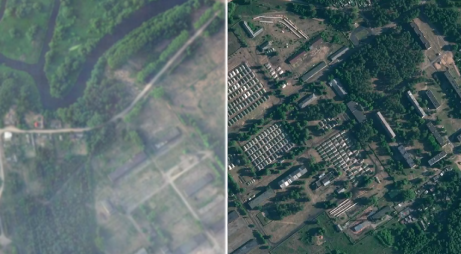
In defense operations, the use of satellite imagery for top-down motion tracking is crucial but challenging due to the scarcity of reliable open sources, underscoring the need for intelligent analysis systems to enhance military capabilities and public safety.

Challenges in Applications Satellite Imagery
Addressing Limitations in Defense Applications of Satellite Imagery
Limited Satellite Image Resolution
The limited resolution of satellite imagery can hinder the ability to identify military assets with a sufficient level of detail

Tracking Motion and Mobility
Tracking the fast and unpredictable motion and mobility of military assets poses a major challenge, especially in expansive regions

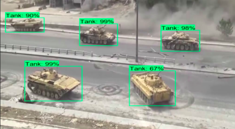
Difficulty in Identifying Military Assets
Accurate identification of military assets from satellite images, particularly in complex or hidden situations, is often difficult

Sigmawave’s Solutions
Sigmawave Introduces the Use of Artificial Intelligence (AI) to Bolster Security and Public Safety Applications
Custom Visual Data for Defense Satellite Analytics
Custom Visual Data for Defense Satellite Analytics: Sigmawave’s revolutionizes defense analytics by using synthetic visual data with satellite imagery as reference. Overcoming satellite image resolution limits, it enhances military asset identification and defense model precision in diverse scenarios
Real-time Precision in Dynamic Motion Tracking
In dynamic military environments, our technology sets a new standard in motion tracking, ensuring high-precision real-time monitoring of fast and unpredictable targets for effective defense operations
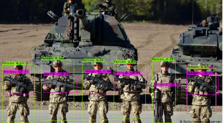
Optimized Remote Military Asset Identification
Elevating innovative system for remote military asset identification enhances defense strategies, aids early threat detection, and bolsters public security by accurately identifying assets, even in complex scenarios
Benefits
Unlocking Benefits in Military Applications with Sigmawave AI
Enhanced Situational Awareness
The integration of Sigmawave’s synthetic visual data and satellite imagery improves military situational awareness, supporting tactical decision-making in various conditions.

Rapid Threat Response
The real-time precision of Sigmawave’s motion tracking allows for a quick response to fast and unpredictable military movements, minimizing risks.
Optimization of Strategic Decision-Making
Excelling in long-range military asset identification, Sigmawave supports strategic decision-making to enhance defense effectiveness.

Increased Operational Efficiency
The integration of synthetic visual data optimizes satellite image resolution, speeding up the identification of military assets and streamlining military operations.
Early Threat Detection
The Sigmawave system excels in early threat detection, providing valuable time for proactive responses and strengthening overall public safety.
Resource Allocation Optimization
High accuracy in military asset identification allows for more efficient resource allocation, enhancing the impact and accountability of defense forces.

